
Proof required with every instalment.
Subsidised projects must submit a network plan to the GIS requirements and photo documentation with every interim and final report.
Source: BNBest-Gigabit
Survey routes, house connections and distribution cabinets during construction – network plan, photo documentation and measurement are created in one go.

¹ Centimetre-accurate with RTK fix (typically 1–3 cm). Accuracy depends on the correction service and reception – see the questions below.
In Germany, telecom rollout is in the overriding public interest until the end of 2030. In the hearing on the 2026 amendment to the Telecommunications Act, municipalities raised concerns about build quality, for example with shallow laying under DIN 18220.
Sources: Grant Thornton; German Bundestag
Subsidised projects must submit a network plan to the GIS requirements and photo documentation with every interim and final report.
Source: BNBest-Gigabit
Coverage is at 62 % homes passed; house connections are hardly ever built without a customer contract.
Source: BREKO market analysis 2026
Cable and utility damage is the most common type of damage in civil engineering, and damage to communication lines is increasing.
Source: VHV construction damage report, civil engineering
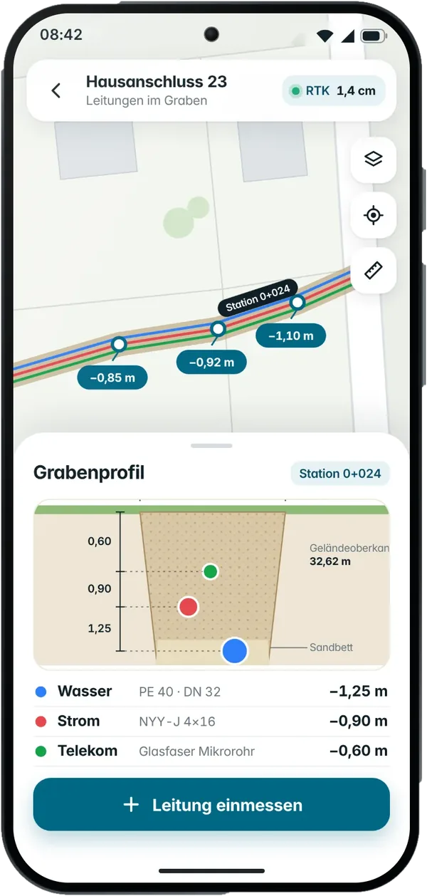
Measure laying depth by laser and document it with photo and coordinates – as evidence for the municipality and network operator.
Source: German Bundestag: hearing on the Telecommunications Act amendment
Import the rollout plan (DXF / Shape) and bill of quantities, create object types: duct bundle, joint, cabinet, house connection.
Before photo per section, then route, house connection duct and head pit in position and depth; for trenchless methods, launch and reception pits.
GIS data for the network plan, photo documentation per section, measurement as REB / GAEB.

StandardFrom PremiumEnterprise
Who: subcontractor
StandardWho: subcontractor
StandardWho: subcontractor
StandardWho: municipality, general contractor
StandardWho: network operator, municipality
EnterpriseWho: subcontractor, general contractor
From PremiumWho: subcontractor
StandardPoints, lines, areas, control points, terrain model, volumes to REB, baseline with dimensions. Triple-band GNSS with RTK, laser for height, tilt compensation up to 45°.
Capture a pipe or cable with the camera, several lines in one shot, a pile or pit as a volume with a 3D point cloud; georeferencing via reference points.

RTK for position, laser for laying depth.
Photo documentation per section is created while surveying.
Measure without coverage, sync with the cloud later.
Network plan to the GIS requirements and billing from the same measurements.
after 12 months 99 €/month
software included for 24 months
Framework agreement for organisations
From Standard to Premium within 12 months for 3.500 €.
Your question isn’t here? Get in touch – we answer personally: +49 30 692098611 or hello@3tag.ai.
Yes. 3tag delivers the network plan in the form required by the GIS requirements of the German gigabit funding programme.
Yes. With trenchless methods you survey the launch and reception pits in position and depth and document them with photos and coordinates – in the same project as the open-cut route.
Via project groups and permissions per project: you give each subcontractor access to the lots they work in. Component lists ensure everyone uses the same duct types and dimensions.
GNSS needs a clear view of the sky; right next to building walls accuracy can drop. The accuracy traffic light shows the quality before every point; uncertain points are flagged. You can also capture ducts in an open trench with the camera (AR), and the laying depth by laser.
From Premium REB DA11 and GAEB X31, plus BoQ import from GAEB with the measured quantity per item. Standard offers PDF report, DXF and text.
We will get back to you within one working day and suggest dates.