
The surveyor arrives too late.
The trench has to be closed, the survey is missing. It stays open or is backfilled without data.
Source: practice in utility construction
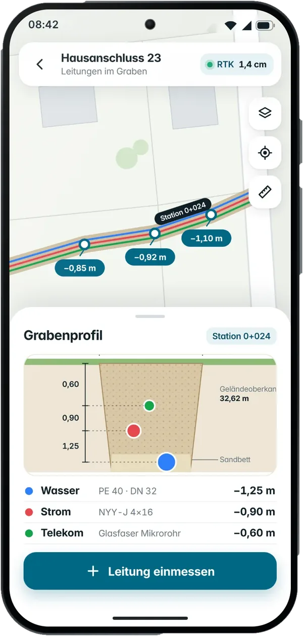
Survey utilities and trenches in position and depth, measure areas and hand over the quantities directly as REB or GAEB – with one device and one person.

¹ Centimetre-accurate with RTK fix (typically 1–3 cm). Accuracy depends on the correction service and reception – see the questions below.
A considerable share of Germany’s special infrastructure fund flows directly into civil engineering. At the same time, construction and surveying jobs have around 318 vacancies for every 100 unemployed people. More contracts with the same staff only work if crews do their own measuring. On e-invoicing from 2027: the measurement goes via REB / GAEB into the tendering and billing software, which creates the invoice.
Sources: EY Parthenon / Börsen-Zeitung; VDI/IW Ingenieurmonitor Q3 2026; ETL
The trench has to be closed, the survey is missing. It stays open or is backfilled without data.
Source: practice in utility construction
Measurement notes turn into REB files and as-built plans – hour after hour in the office.
Source: practice in civil engineering
The total cost of utility damage is on average around 29 times the pure repair cost.
Source: BIL eG
Create the project in the office, import the route plan and bill of quantities.
Record pipes, manholes and areas in position and depth, stake out routes and foundations, take photos.
Assign quantities to the BoQ items, export the as-built plan and REB / GAEB.

StandardFrom Premium
With sections for road and sewer construction, planners and stockpile volumes
As-built record before backfilling
StandardProve excavation and fill
From PremiumNo waiting for the surveyor
StandardInvoice without retyping
From PremiumAcceptance without queries
From PremiumProve areas and lengths (billing to the BoQ from Premium)
StandardHeights by laser
From PremiumStock on a given date
From PremiumChecks under HOAI LPH 8
From PremiumPoints, lines, areas, control points, terrain model, volumes to REB, baseline with dimensions. Triple-band GNSS with RTK, laser for height, tilt compensation up to 45°.
Capture a pipe or cable with the camera, several lines in one shot, a pile or pit as a volume with a 3D point cloud; georeferencing via reference points.

Under the German fee structure for architects and engineers (HOAI, work stage 8), site supervision includes checking the contractors’ measurements. With 3tag you check by spot sample (from Premium). There is also a model clause for your bills of quantities: “Documentation in position and depth with photo, export DXF / Shape, measurement REB”.
Source: BauNetz Wissen: work stage 8
Height transfer by laser – even in deep trenches.
Import bills of quantities, quantity proof as REB DA11 and GAEB X31 (from Premium).
Projects and permissions for foremen, survey crews and billing.
Onboarding and support from Germany, by phone from Premium.
Benndorf Bau (civil and utility construction) · Omexom (network and utility construction) · MVV Netze (network operator) · E.ON / BTB Energie (energy supplier)
after 12 months 99 €/month
software included for 24 months
Framework agreement for organisations
From Standard to Premium within 12 months for 3.500 € – you lose nothing by starting small.
Your question isn’t here? Call us on +49 30 692098611 or book a demo right away.
Centimetre-accurate with an RTK fix; accuracy depends on the correction service and reception. The integrated laser transfers the height; fix status and check measurements appear in the report.
GNSS needs a clear view of the sky. Right next to building walls or in deep trenches accuracy can drop – that applies to every satellite-based system. The accuracy traffic light shows the quality before every point; uncertain points are flagged in the cloud. You can also capture pipes in an open trench with the camera (AR).
Standard exports DXF and text. From Premium you also get DWG, Shape, GeoPackage, GML, KML as well as REB DA11 and GAEB X31. Custom export formats to the client’s specification are part of Enterprise.
Not for official surveys or large route surveys. Day-to-day surveying, measurement and staking out on site are handled by your own team – without waiting for an appointment.
3tag receives correction data via NTRIP (RTCM 3.x). The first 4 weeks are included – we set up access for you at the start. After that you have two options: switch to the SAPOS service of your German state (application per state; costs and terms differ, free of charge in some states), or use our service via RTKdata or u-blox for €30 per month (plus VAT) – across states and countries, with no applications of your own. From Premium, Galileo HAS is also available without mobile data (decimetre-level accuracy).
We’ll get back to you within one working day and suggest dates.